Post by glactus on Oct 27, 2011 2:44:02 GMT
This is an amazing satellite with incredible capabilities as the Video Below will show.
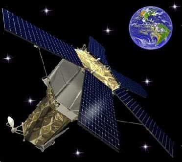
GeoEye-1 is a high-resolution Earth observation satellite owned by GeoEye, which was launched in September 20 2008

The GeoEye -1 satelite
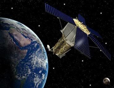
GeoEye-1 provides 41 cm (16 in) panchromatic and 1.65 m (5.4 ft) multispectral imagery in 15.2 km (9.4 mi) swaths of the Earth. The spacecraft is a sun-synchronous orbit at an altitude of 684 km (425 mi) and an inclination of 98 degrees, with a 10:30 a.m. equator crossing time. GeoEye-1 can image up to 60 degrees off nadir, and is operated out of Dulles, Virginia.

GeoEye -1 Earth watch
At the time of its launch, GeoEye-1 was the world’s highest resolution commercial earth-imaging satellite. GeoEye-1 was manufactured in Gilbert, Arizona by General Dynamics and launched from Vandenberg Air Force Base in California. The first image was returned on October 7, of Kutztown University in Pennsylvania.

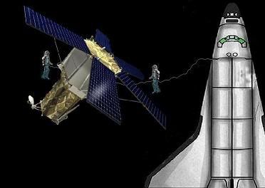
Space art - Inspecting the GeoEye - 1 Satellite
Google, which has its logo on the side of the rocket, has exclusive online mapping use of its data. While GeoEye-1 is capable of imagery with details the size of 41 cm (16 in), that resolution will only be available to the US government. Google will have access to details of 50 cm (20 in). Prior maximum commercial imagery was 60 centimetres (24 in).
The National Geospatial-Intelligence Agency and Google both paid $502 million for the satellite and upgrades to GeoEye's four ground stations.
To see amazing video of the capabilities of this Hi Tech imaging satellite just click on the link below. Has sound
www.g4tv.com/videos/36876/tom-clancys-hawx-geoeye-satellite-mapping-video/

Credits: These are non copywrite images.
text by Wikipedia
Space art by glactus
Video by g4ty.com
GeoEye-1 is a high-resolution Earth observation satellite owned by GeoEye, which was launched in September 20 2008

The GeoEye -1 satelite
GeoEye-1 provides 41 cm (16 in) panchromatic and 1.65 m (5.4 ft) multispectral imagery in 15.2 km (9.4 mi) swaths of the Earth. The spacecraft is a sun-synchronous orbit at an altitude of 684 km (425 mi) and an inclination of 98 degrees, with a 10:30 a.m. equator crossing time. GeoEye-1 can image up to 60 degrees off nadir, and is operated out of Dulles, Virginia.

GeoEye -1 Earth watch
At the time of its launch, GeoEye-1 was the world’s highest resolution commercial earth-imaging satellite. GeoEye-1 was manufactured in Gilbert, Arizona by General Dynamics and launched from Vandenberg Air Force Base in California. The first image was returned on October 7, of Kutztown University in Pennsylvania.

Space art - Inspecting the GeoEye - 1 Satellite
Google, which has its logo on the side of the rocket, has exclusive online mapping use of its data. While GeoEye-1 is capable of imagery with details the size of 41 cm (16 in), that resolution will only be available to the US government. Google will have access to details of 50 cm (20 in). Prior maximum commercial imagery was 60 centimetres (24 in).
The National Geospatial-Intelligence Agency and Google both paid $502 million for the satellite and upgrades to GeoEye's four ground stations.
To see amazing video of the capabilities of this Hi Tech imaging satellite just click on the link below. Has sound
www.g4tv.com/videos/36876/tom-clancys-hawx-geoeye-satellite-mapping-video/
Credits: These are non copywrite images.
text by Wikipedia
Space art by glactus
Video by g4ty.com


